Mid-Afternoon Map: Four Maps for the Fourth
Welcome to Mid-Afternoon Map, our exclusive members-only newsletter that provides a cartographic perspective on current events, geopolitics, and history from the Caucasus to the Carolinas. Subscribers can look forward to interesting takes on good maps and bad maps, beautiful maps and ugly ones — and bizarre maps whenever possible. *** Miguel Covarrubias, United States of America, 1942 The 1940s were, without a doubt, America’s golden age of patriotic pictorial maps. As the country emerged from the Great Depression onto the world stage, its artists and illustrators created a series of cartographic masterpieces like this one. With equal parts pride and whimsy, they embraced the challenge of depicting everything American about America — The post Mid-Afternoon Map: Four Maps for the Fourth appeared first on War on the Rocks.
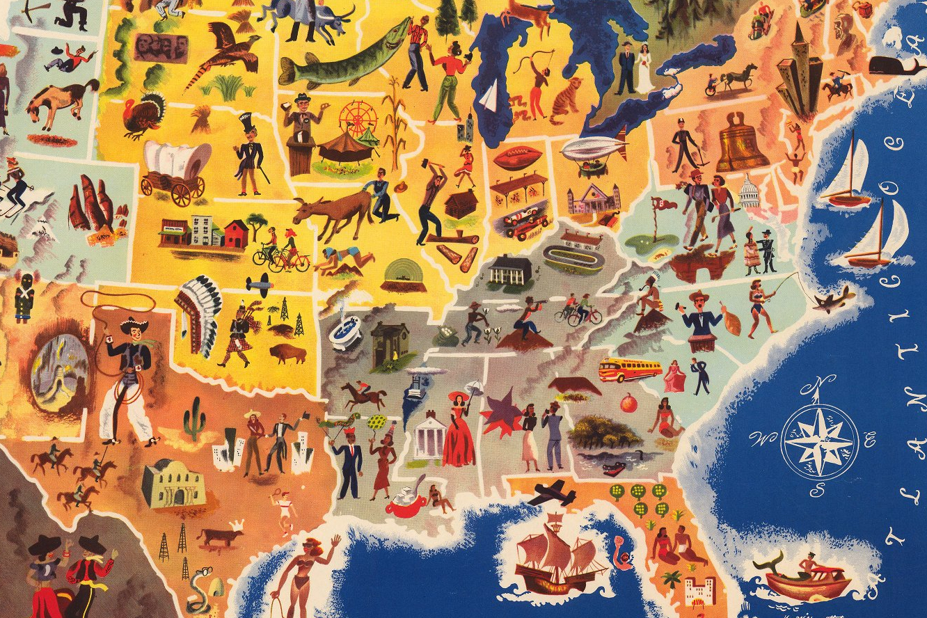
Welcome to Mid-Afternoon Map, our exclusive members-only newsletter that provides a cartographic perspective on current events, geopolitics, and history from the Caucasus to the Carolinas. Subscribers can look forward to interesting takes on good maps and bad maps, beautiful maps and ugly ones — and bizarre maps whenever possible. *** Miguel Covarrubias, United States of America, 1942 The 1940s were, without a doubt, America’s golden age of patriotic pictorial maps. As the country emerged from the Great Depression onto the world stage, its artists and illustrators created a series of cartographic masterpieces like this one. With equal parts pride and whimsy, they embraced the challenge of depicting everything American about America —
The post Mid-Afternoon Map: Four Maps for the Fourth appeared first on War on the Rocks.